
Scenario
This lesson combines 2 MBS Floor Plan files with different coordinate systems into one file using external references and room transformations.
School-Main-2.mbs: Contains survey stations, building footprint and middle building rooms. In other words the school building footprint has been surveyed from control stations using a total station and the school entrance rooms and hall have been surveyed into the same file using a Disto.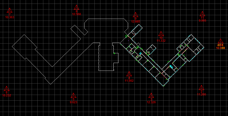
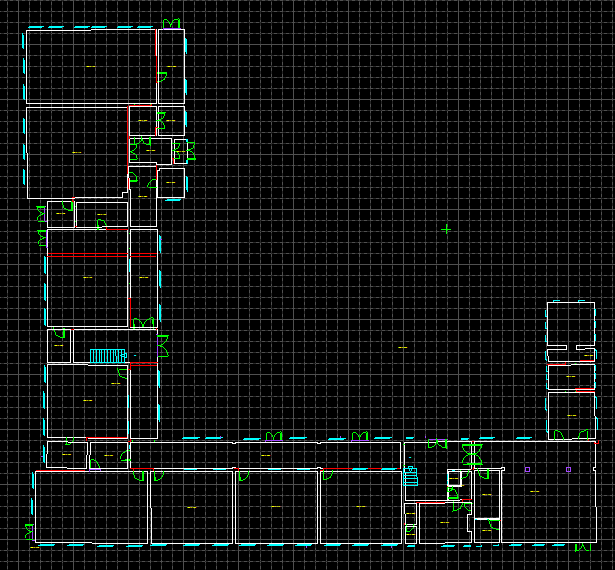
School-West-wing-2.mbs: Contains the rooms of the west wing only, not referenced to the main survey. In other words a brand new file with arbitrary coordinates was started and the west wing school rooms and symbols, have been recorded and surveyed using a Disto.
The Process
The process followed in this lesson and scenario to combine the two files with different coordinate systems is to:
- Open the file with the correct coordinate system, in this case; School-Main-2.mbs and save it.
- Insert School-west-wing-2.mbs as an External Reference.
- Transform the rooms from the inserted School-west-wing-2.mbs in three stages:
- The first moves the 2 datasets closer together so we can get a better view and fit of them using Room Transformation – By Arbitrary Amount.
- The second stage transforms the rooms To a Measured Point in School-Main-2.mbs with an offset.
- The third stage Rotates the imported rooms to match up with a wall in School-Main-2.mbs.
Each of these stages are available in separate video files:
1. Insert an External Reference
Note: Desktop with Black background
2. Transform Rooms by Arbitrary Amount
Note: Desktop with Black background
3. Transform Rooms to Measured Point
Note: Tablet with White background
4. Transform Rooms by Rotating to Match Wall
Note: Tablet with White background